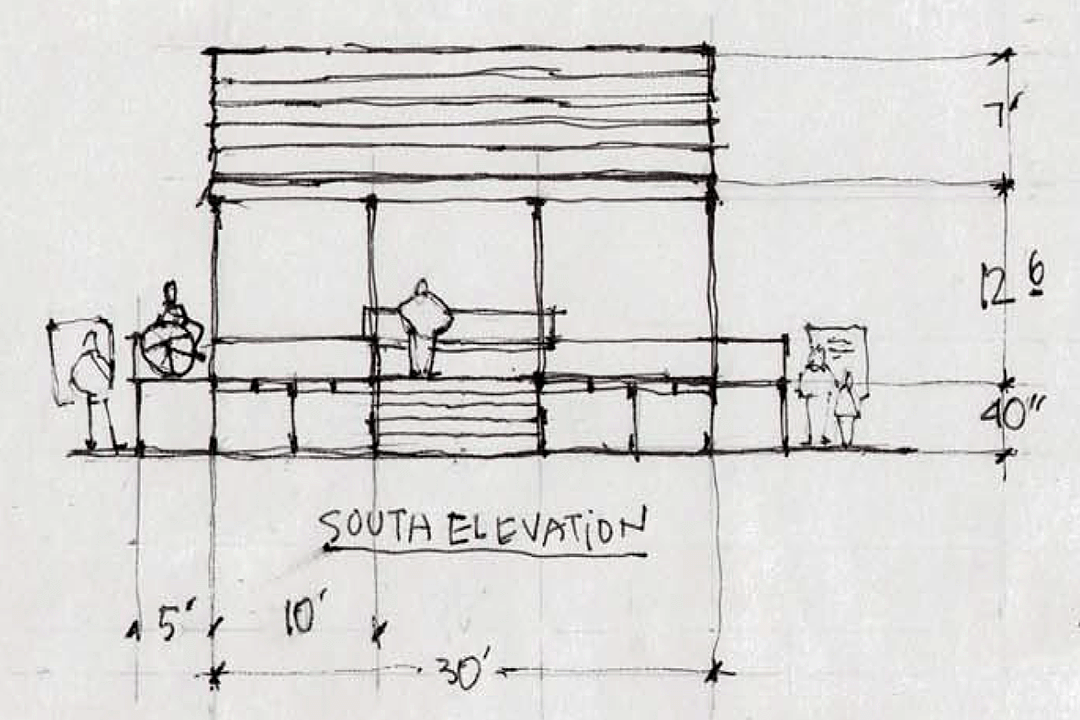
Featured Image: South Elevation drawing of the Ferguson Pavallion Proposal.
Tap Here to view the full proposal.
Ferguson Performance Pavillion and Snohomish River Overlook
The idea of building a performance pavilion on the site of the gazebo that would echo the town’s first home — the Ferguson Cottage — came to me in 2008 as an event to mark Snohomish’s 150 Year Anniversary the following year.
The gazebo looked done in then.
So was encouraged to read in the news that the city was looking for alternatives to sprucing up the gazebo — Future of First Street Gazebo to be discussed and The venerable Snohomish gazebo is in need of a remodel.
And I am pleased to present this proposal of an idea that has stood the test of time in my mind.
The Ferguson Cottage
The idea begins with knowing about the first home built of milled lumber and located on the bluff overlooking the Snohomish River. I made this short movie in 2015 and it features an interview with the late David Dilgard with the Northwest Room of the Everett Public Library who discovered and documented the historic home in 1981.
(Follow this link to view Part II.)
The Ferguson Performance Pavilion.
The project calls for a design+build team to create a structure of fine woodworking — as if a piece of furniture! Might be a project for a local carpenter training program, as Ferguson was trained as a carpenter. How poetic would it be if built off-site in sections then assembled on-site, just as Ferguson did building his cottage in Steilacoom and shipped in pieces to his claim overlooking the river!
Snohomish River Overlook.
Tapping on my skills as a scenic designer in another life, I’ve prepared a sketch plan based on a scale print of Avenue A provided by City Project Manager Brennan Collins, (who watched over the stunning Carnegie renovation) to confirm that the idea of the structure would fit the site.
It’s a simple square deck 30×30 feet and 40 inches high, a few inches higher than the gazebo. The performance (and gathering space) is bordered on the east and west sides with ADA ramps — encouraging one-way visitor traffic. The south side would hang over the bluff and feature a 10-foot long timeline graphic of the river’s north bank development — from annual Indian berry harvesting camps to the currently abandoned lumber mill — which I look forward to doing.
As well as interpretative signs located at the base of each ramp. And a clear directional sign directing visitors to the River Front Trail, which surprisingly does not exist.
What to Do with the Gazebo?
Finally, I wish to throw out an idea that’s taken from Burning Man’s popular event of burning the temple at the end of the week-long festival — residents are invited to write messages on the structure and the fire department supervises its burning, perhaps on the Winter Solstice 2021?!
Thanks for reading, please share, and I welcome your comments below ~w.

